
Bering Superstorm
An extraordinarily intense storm is now churning through the Bering Sea.
The central pressure is roughly 945 hPa–similar to a category three hurricane, and in fact this storm does have hurricane force winds. Take a look at a recent National Weather Surface surface analysis (for 4 PM Tuesday). 943 hPa low center and the NWS folks note the hurricane-force winds (sustained winds of 64 kt or more). That is a lot of isobars, with extraordinary pressure gradients.

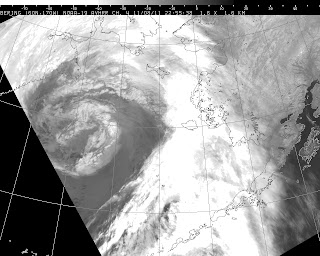
It is quite unusual to have a storm that strong so far north. This storm developed very rapidly–approximately 60 hPa in 48 h, thus putting it in the category of explosive deepeners or “meteorological bombs” as known in the weather literature. Here is an image of the storm from of the polar orbiter weather satellites…the low center is in the middle of the swirl.
The has passed near a few weather buoys. Here are a few samples. Buoy 46070, found in the western Bering (see map) had a minimum pressure of 28.2 inches of Hg (954 hPa) and gust to nearly 60 kts.
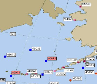

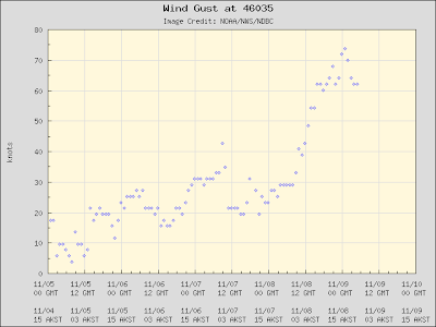
Or Buoy 46035 (to the east) with gusts to 75 knots!
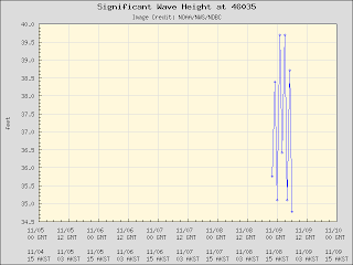
Wave heights at these locations climbed above 35 ft:

Coastal flooding and blizzard conditions add to the mix. In any case, this will be one of the great storms of the year.
You Might Also Like Our Friends' Posts
Comments are closed for this story.


 Choosing from the best US Canadian and international sources, we gather and select weather stories from around the world. World Weather Post not only brings you breaking news about people affected by weather, but also provides insight on how weather is affected by people. You will also find a sense of humour and a curiosity for understanding the weather, climate change and the environment. World Weather Post, where everybody talks about the weather.