
Major Coastal Storm
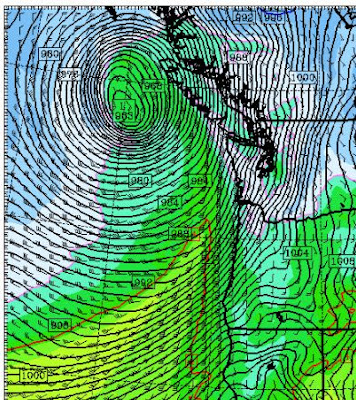
Forget the snow showers and other minor weather annoyances. We got bigger fish to fry. A major cyclone will rapidly develop on Sunday and then move northward off our shore, crossing the northern portion of Vancouver Island. A storm that will produce strong winds and substantial waves along the Northwest coast, but far enough out to lessen the the threat of a major windstorm over most of the interior. Here is the latest UW WRF forecast (12km domain) for 7 AM on Monday. Most of the major modeling systems…including the ensemble systems…agree with this solution, so there is a good chance reality will be similar. A very strong low center of 963 hPa, with intense pressure gradients around it. Large gradients down the Strait and along the Oregon coast as well. Shift this low 150 miles to the east and we would have real problems over Puget Sound.
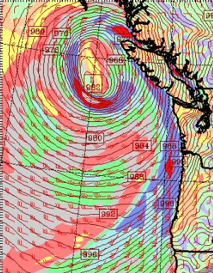
Here is the forecast SUSTAINED wind speed (in knots) at the same time. 50 kts along the coast and well over 50 knots south and east of the low center. That area is sometimes called the “poisonous tail of the bent-back occlusion.”

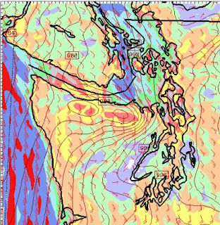
Here is a blow up for western Washington: you can see there will very strong winds over NW Washington as well, particularly towards Victoria. I don’t know whether I would take the Victoria Clipper on Monday! (I bet they cancel).
As the low approaches Vancouver Island, the winds along the northern third will be extreme, with hurricane force gusts. Here is the forecast at 10 AM Monday. Wow. Solander Island may well see winds over 100 mph.
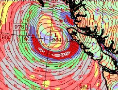
Keep in mind that the low could shift east or west a bit from this forecast..but probably not much.
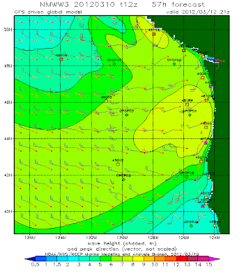
Of course, such a fierce storm will kick up substantial waves, although the rapidity of its development and its quick motion will work against the really big stuff. Remember big waves require strong winds, with large fetch and long duration. We have the first, but lack a bit in the second and third. Here is the forecast from the NWS Wavewatch III model for Monday at 1 PM. 8-9 meter (26-29 foot) waves along the coast. Not a good day to be fishing out there. But a good one to head to the shore to watch big waves and to thrill in the winds. (Editorial Comment: I still believe we undervalue the value of storm tourism along the coast–and the attraction of a storm, tsunami, and shipwreck museum out there. The coast hotels and B& Bs should be packed on Sunday night with people ready to experience a big storm).
The amazing thing is that we can predicts such storms. Essentially it doesn’t exist now, and on Sunday it will develop explosively….we call such storms “bombs.” Here is a surface map at 1 PM on Saturday and every 12 hrs so you can appreciate how quickly this event forms out of a minor trough:


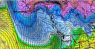
Right now the incipient trough is WEST of the tip of the Aleutians. Its extraordinary we can make these predictions…and be right so often.
You Might Also Like Our Friends' Posts
Comments are closed for this story.

 Choosing from the best US Canadian and international sources, we gather and select weather stories from around the world. World Weather Post not only brings you breaking news about people affected by weather, but also provides insight on how weather is affected by people. You will also find a sense of humour and a curiosity for understanding the weather, climate change and the environment. World Weather Post, where everybody talks about the weather.