
Tropical Storm Muifa Blasts North Korea and China

South Korean residents pass by abalone farms destroyed by Typhoon Muifa in Wando, South Korea, Monday, Aug. 8, 2011. Typhoon Muifa pounded South Korea’s west coast, leaving at least one dead and two others missing as it proceeded northward to reach the capital of Seoul Monday morning, the meteorological office and the emergency control agency said. (AP Photo/Yonhap, Hyung Min-woo)

By Rob Miller, Senior Meteorologist
Aug 9, 2011; 8:29 AM ET
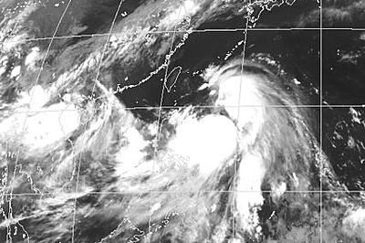
Tropical Storm Muifa made landfall near the border of North Korea and China late Monday, local time, unleashing torrential rainfall and locally strong winds on the region.
At the time of landfall, maximum sustained winds were between 50-55 mph (80-90 kph), while wind gusts were as high as 60-65 mph (95-105 kph).
However, the main impact from Muifa was the torrential rains unleashed over North Korea and adjacent China. More than 5 inches (125 mm) of rain has fallen over some areas of flood-wary North Korea and China.
Heavy rain also impacted much of South Korea, including Seoul, where at least 1 person lost their life and 2 people remain missing.
In wake of recent months of heavy rain, this heavy rain from Muifa was not needed. This latest round of heavy rain has lead to more than 2,400 acres of damaged crops, according to North Korean officials. Officials also have reported more than 100 houses and 10 public buildings were destroyed from Muifa.
Muifa developed as a tropical depression on July 25th and became a tropical storm on July 28th. Further strengthening ensued, becoming a typhoon on July 30th. In fact, rapid strengthening occurred, and Muifa was briefly a Super Typhoon, with sustained winds near 160 mph (250 kph), on July 31st.
Muifa was a large storm system, with outer rain bands reaching several hundred miles away from the center of the storm. A few of these rain bands reached the northern Philippines, where heavy rain produced flooding and landslides. At least 4 people lost their life over the northern Philippines as a result of the flooding and landslides.
Largely dry weather will settle across North Korea and nearby China for the next few days, allowing cleanup efforts to proceed without many problems. However, by the end of the week, a storm system may approach from the west, with the threat for locally heavy rain returning to the Korean Peninsula and nearby China.
You Might Also Like Our Friends' Posts
Comments are closed for this story.



 Choosing from the best US Canadian and international sources, we gather and select weather stories from around the world. World Weather Post not only brings you breaking news about people affected by weather, but also provides insight on how weather is affected by people. You will also find a sense of humour and a curiosity for understanding the weather, climate change and the environment. World Weather Post, where everybody talks about the weather.