
GOES-West Weather Satellite Fails
Yesterday the National Weather Service GOES-West (GOES-15) geostationary weather satellite failed. In a geostationary orbit that allows it to stay above the same location in time, GOES-W is positioned over the equator at 135W at around 36,000 km above the surface.
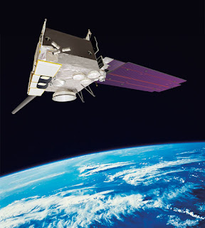
The folks at the National Weather Service are trying to bring it back, but right now there is no information on how long this will take or whether they will succeed.
In the meantime, we are getting images from the other U.S. geostationary satellite (GOES-E) positioned over the equator at 75W, but that results in distorted images over the Northwest and coverage rapidly fading out over the Pacific (see two samples of images this morning…the first infrared, the second visible).


In addition to the geostationary weather satellites, the U.S. has several polar orbiting satellites that circle the earth at a much lower altitude (about 800 km) and view the earth in relatively narrow swaths (about 2000 km wide). The trouble is that this coverage is not continuous, but at least we get a view everywhere at regular intervals. And of course we have our coastal radar painting out approach weather along the Washington coast! As you can see below, a line of showers is approaching us Thursday AM…

You Might Also Like Our Friends' Posts
Comments are closed for this story.


 Choosing from the best US Canadian and international sources, we gather and select weather stories from around the world. World Weather Post not only brings you breaking news about people affected by weather, but also provides insight on how weather is affected by people. You will also find a sense of humour and a curiosity for understanding the weather, climate change and the environment. World Weather Post, where everybody talks about the weather.