
Lenticular Clouds
Today there were wonderful displays of lenticular clouds (a.k.a. mountain wave clouds) downstream of both the Olympics and Mt. Rainier. Here are a few photos to enjoy. First one from the cam on top of my building, facing towards the Olympics:

Or one downstream of Mt. Rainier, again from my building:

A far better picture taken by Kevin Freitas in Tacoma was found online at this website:

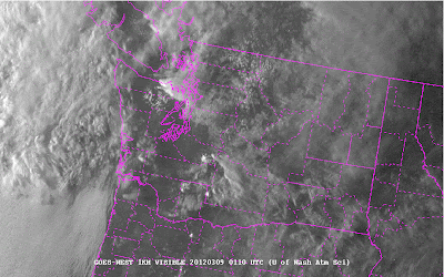
You could see these lenticular clouds from space as viewed in the high-resolution visible satellite photo right before sunset.
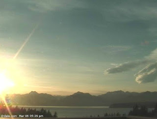
And here is one from Dale Ireland’s famous cam in Silverdale:
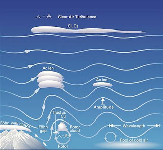
Why do we get such features? They occur when air, often near saturation, approaches a mountain barrier. Pushed up by the mountains, the air goes into an oscillation, with the waves propagating both downstream and upward. Here is a schematic of the process:
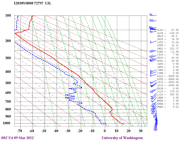
To see what the air approaching our region looked like today, here is a vertical sounding at Quillayute, near the Washington coast at 4 PM today. Red is temperature and blue indicates dewpoint. The closer they are the near to saturation the air. The numbers of the left indicate pressure (500 is roughly 18K feet, 700 around 10K feet, etc). The air is close to saturation above 18K feet, with winds from southwest. Good situation for lenticular clouds.
Did the super-hi resolution WRF model (4/3 km resolution) simulate these clouds? You know the answer! Here is the simulated cloud field at 4 PM. You see a veil of high clouds with the mountain wave clouds embedded in them. Pretty impressive forecast (12 h ahead).

Finally, if some of you are VERY lucky you might sneak a peak of the aurora tonight…but its a race against the approaching clouds.
You Might Also Like Our Friends' Posts
Comments are closed for this story.


 Choosing from the best US Canadian and international sources, we gather and select weather stories from around the world. World Weather Post not only brings you breaking news about people affected by weather, but also provides insight on how weather is affected by people. You will also find a sense of humour and a curiosity for understanding the weather, climate change and the environment. World Weather Post, where everybody talks about the weather.