
Leap Day Blizzard for Pierre, Duluth Others

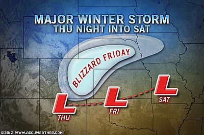
A blizzard will continue to affect portions of the Upper Midwest during Leap Day 2012 with very heavy snow, low visibility and gusty winds.

By Alex Sosnowski, Expert Senior Meteorologist
Feb 29, 2012; 8:07 AM ET
Feb. 29 happens only once every four years, so blizzards on this date are much more rare than any other day in the winter. Wednesday is Leap Day 2012.
According to Senior Meteorologist Kristina Pydynowski, “Conditions experienced in height of the storm will range from disruptive to immobilizing along portions of I-29, I-90 and I-94.”
Cities being hit by the storm today include Fargo and Jamestown in North Dakota, Pierre, Huron and Aberdeen in South Dakota and Duluth and St. Cloud in Minnesota.
Even while snow tapers off from west to east over the Dakotas, gusty winds will continue to cause extensive blowing and drifting of the snow on the ground.
**The worst of the storm during the midday hours today was from east-central Minnesota to northern Wisconsin and parts of the upper Michigan and northern lower Michigan peninsulas.**
**The storm has already delivered over a foot of snow to portions of northern Wisconsin and central Minnesota. In portions of eastern South and North Dakota accumulations range from a few inches to nearly a foot. There have been reports of snow drifts to several feet in some locations over the northern Plains.**

For a larger snowfall forecast map is available on AccuWeather.com’s Winter Weather Site.
There can even be thunder and lightning in portions of the heavy snow area.
The storm will also have a warm side to it as many often do with a zone of rain and thunderstorms. Damaging and deadly storms have occurred.
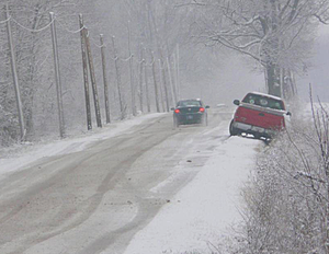
 Photo from Groundhog Day Blizzard in Chicago on Feb. 2, 2011 by AccuWeather.com Facebook fan Laercio L.
While the blizzard diminishes over the northern Plains and the Upper Midwest later today, heavy snow will fall on portions of theNortheast into Thursday.
Meteorologist Bill Deger contributed to the content of this story.
You Might Also Like Our Friends' Posts
Comments are closed for this story.




 Choosing from the best US Canadian and international sources, we gather and select weather stories from around the world. World Weather Post not only brings you breaking news about people affected by weather, but also provides insight on how weather is affected by people. You will also find a sense of humour and a curiosity for understanding the weather, climate change and the environment. World Weather Post, where everybody talks about the weather.