
Climatologically, The Worst of Winter is Over!
Yes, you read that right.
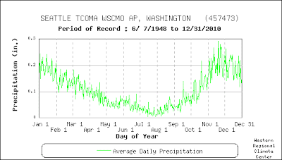
The last week or two of November is climatologically the worst period of the year by many measures. For example, consider the average precipitation per day at Sea-Tac Airport (below). It peaks in last November and most of December is a drier.
Or how about extreme daily precipitation at the same location?
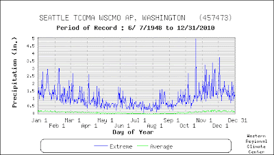
Big peaks in November and a radical reduction in extreme precipitation in December.
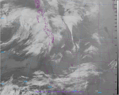
Just like clockwork there is going to be a major break in the coming up this week, but first we have to get through one more storm. A low center and accompanying clouds and precipitation is moving towards us from the northwest and should bring precipitation to the region late tomorrow and Wednesday AM. You can see it off our coast in this satellite image:
This system should be unremarkable. After that a very strong ridge will build northward into the eastern Pacific and will remain in place for at least a week. You heard me…a week.
Like Wednesday morning
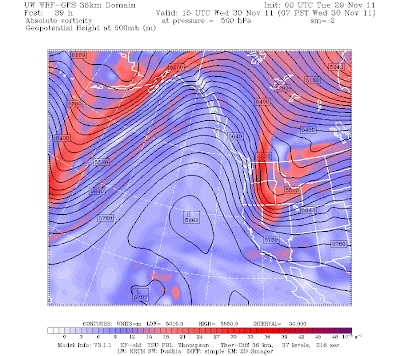
Thursday morning
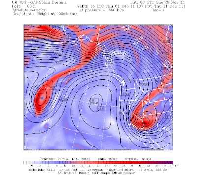
Friday morning

Saturday morning
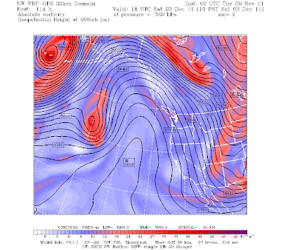
You get the idea. And we will have lots of sun…and some fog in the AM. The biggest threat to your life and safety will be ice on the roadways.
The National Weather Service has this regime going into next week…here is their latest 6-10 day precipitation forecast: below normal in the West.
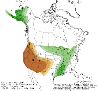
This looks like a good time for local meteorologists to go on vacation. Or to rake some leaves.
You Might Also Like Our Friends' Posts
Comments are closed for this story.


 Choosing from the best US Canadian and international sources, we gather and select weather stories from around the world. World Weather Post not only brings you breaking news about people affected by weather, but also provides insight on how weather is affected by people. You will also find a sense of humour and a curiosity for understanding the weather, climate change and the environment. World Weather Post, where everybody talks about the weather.