
Snow Update
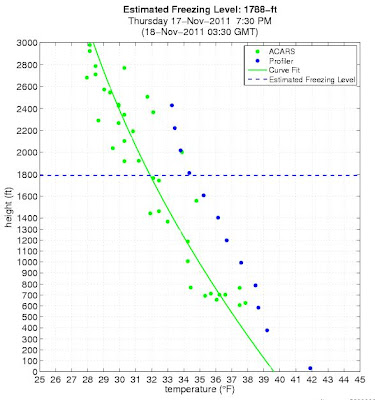
It is is looking increasingly unlikely there will be any significant snow over the lowlands tonight north and west of Olympia. Just a few scattered snow showers, particularly over higher hills. The latest model runs show far less precipitation and a much more amorphous low center (see graphic below). Less cold air moving in…in fact, the freezing level has gone up to
 |
| Forecast 4 AM sea level pressure and temperatures |
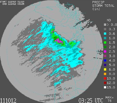
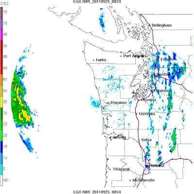
2000 ft, which implies a roughly 1000 ft snow-level. Our wonderful new Langley Hill radar show some strong showers coming to the coast right now…but very little significant precipitation behind it (see below):
 |
| 8:20 PM radar |
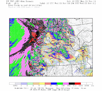
The ensemble forecasting system and probcast concur on predicting dry conditions for the Sound and northwards, but some light snow showers to the southeast of the Sound. Perhaps some light snow over the NE slopes of the Olympics and eastern Vancouver Is. Here is the predicted 24-h snowfall ending 4 PM Saturday. There could be some light snow in the Centralia/Chehalis area and over SW Washington. Of course, with it being cold enough for snow tomorrow morning…so we will need to be attentive for the forecast going wrong…

Mixed clouds and sun tomorrow after the late morning, but quite cool (lower 40s should be it). Heavy rain still on tap for Tuesday. This is a serious threat for those living near the Olympic Mountains…and will be the first major event observable with the new Langley Hill radar.
You Might Also Like Our Friends' Posts
Comments are closed for this story.

 Choosing from the best US Canadian and international sources, we gather and select weather stories from around the world. World Weather Post not only brings you breaking news about people affected by weather, but also provides insight on how weather is affected by people. You will also find a sense of humour and a curiosity for understanding the weather, climate change and the environment. World Weather Post, where everybody talks about the weather.