
Hurricane Irene continues to become better organized, takes aim at Bahamas

Figure 1. True-color image of Hurricane Irene taken at 11:20am EDT Monday August 22, 2011, shortly after Irene moved off the coast of Puerto Rico. At the time, Irene was a Category 1 hurricane with 80 mph winds. Image credit: NASA.
Track forecast for Irene
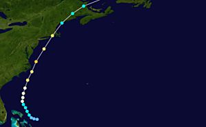
The models agree that the center of Irene will stay north of Hispaniola, which will allow the storm to continue to organize. The question that remains is how the trough of low pressure, which is expected to move across the Eastern U.S. on Wednesday and Thursday, will affect Hurricane Irene. The timing and strength of this trough, as well as the intensity of the hurricane, will determine just how quick Irene will turn away from the U.S. coast, if at all. This afternoon, the GFDL has finally started to inch its forecast track to the east, with a landfall in southern Florida. Both the HWRF and the UKMET models are suggesting a landfall in South Carolina, and the ECMWF and the GFS are forecasting a brush with the Outer Banks of North Carolina. The official forecast from the National Hurricane Center is a track north of Hispaniola over the next 24 hours, and through the Bahamas Wednesday and Thursday. While the center of the Hurricane Center’s cone of uncertainty has Irene making landfall near the North Carolina/South Carolina border, it’s important to note that the error in 4 and 5 day track forecasts remains high—around 200 miles in either direction. The official track has nudged a bit east since this morning, which reduces the threat to southern Florida, but increases the threat to the Carolinas.
Intensity forecast for Irene
The environment around Hurricane Irene remains moist, and wind shear is expected to remain relatively low (5 to 15 knots) along its forecast path over the next 5 days. Sea surface temperatures are certainly warm enough (29-30°C) to support intensification to a major hurricane (category 3+). Irene is still disorganized on its south side due to land interaction and dry air, but recent satellite imagery suggests increasing outflow at high levels to the south of the center, which is necessary for the hurricane to intensify. Both the GFS and the ECMWF are forecasting Irene to develop into a very large and intense hurricane. The National Hurricane Center expects Irene to intensify to a category 2 hurricane tomorrow evening as it moves away from Hispaniola. Beyond that, Irene will most likely intensify into a category 3 major hurricane with maximum sustained winds around 110 mph. Like Jeff said this morning, however, Irene could just as easily remain a category 2, or even reach category 4 wind speeds. In any case, Irene will be a powerful hurricane and a serious threat to the Bahamas and the East Coast of the United States.
Angela
You Might Also Like Our Friends' Posts
Leave a Reply


 Choosing from the best US Canadian and international sources, we gather and select weather stories from around the world. World Weather Post not only brings you breaking news about people affected by weather, but also provides insight on how weather is affected by people. You will also find a sense of humour and a curiosity for understanding the weather, climate change and the environment. We encourage you to use our blog to express your opinion and share your stories and knowledge. World Weather Post, where everybody talks about the weather.