
Damaging freeze hits the Midwest U.S.

Figure 1. Temperatures this morning dipped below freezing across most the northeast quarter of the country, extending into Tennessee and North Carolina. Image taken from our wundermap with the new “go back in time” feature turned on.
History of billion-dollar U.S. freezes
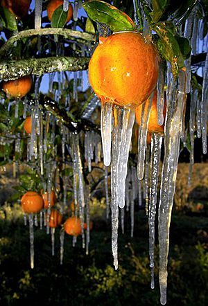
Freezes can cause big damage to agriculture. According to NOAA’s National Climatic Data Center, there have been six billion-dollar U.S. freezes since 1980, accounting for 5% of all billion-dollar weather-related disasters. Five of these freezes affected California or Florida; one hit the Midwest. Ranked by damages (in 2011 dollars), here are the six billion-dollar U.S. freeze events since 1980:
1) California Freeze of December 1990. Severe freeze in the Central and Southern San Joaquin Valley caused the loss of citrus, avocado trees, and other crops in many areas. Several days of subfreezing temperatures occurred, with some valley locations in the teens. $5.9 billion in direct and indirect economic losses, including damage to public buildings, utilities, crops, and residences.
2) Florida Freeze of December 1983. Severe freeze central/northern Florida; about $4.5 billion damage to citrus industry.
3) California Freeze of December 1998. A severe freeze damaged fruit and vegetable crops in the Central and Southern San Joaquin Valley. Extended intervals of sub 27° F temperatures occurred over an 8-day period; $3.5 billion estimated damages/costs.
4) Florida Freeze of January 1985. Severe freeze in central/northern Florida; about $2.5 billion damage to citrus industry.
5) East/Midwest freeze of April 2007. Widespread severe freeze over much of the East and Midwest (AL, AR, GA, IL, IN, IA, KS, KY, MS, MO, NE, NC, OH, OK, SC, TN, VA, WV), causing significant losses in fruit crops, field crops (especially wheat), and the ornamental industry. Temperatures in the teens/20′s accompanied by rather high winds nullified typical crop-protection systems. Over $2.2 billion in damage/costs.
6) California Freeze of January 2007. For nearly two weeks in January, overnight temperatures over a good portion of California dipped into the 20′s, destroying numerous agricultural crops, with citrus, berry, and vegetable crops most affected. $1.5 billion estimated in damage/costs; 1 fatality reported.
Record warmth in the Western U.S.
As is often the case when one part of the country is experiencing much cooler than average temperatures, the other half is seeing record warmth, due to a large bend in the jet stream that allows warm air to flow northwards. Much of Wyoming, Montana, Idaho, and Colorado experienced record warm temperatures yesterday. Most notably, Jackson, Wyoming hit 72°F, the earliest 70° reading in their history, and 27° above their normal high of 45°.

Figure 2. Severe weather risk for Saturday, April 14, 2012, from NOAA’s Storm Prediction Center.
Tornado outbreak possible Saturday in Kansas and Oklahoma
A significant tornado outbreak is possible on Saturday, says NOAA’s Storm Prediction Center. A warm, unstable airmass will collide with cold air funneling down from Canada, and strong jet stream winds will create plenty of wind shear. There is the potential for long-track strong tornadoes over Oklahoma and Kansas on Saturday, and SPC has has issued their second highest level of alert, a “Moderate Risk,” for the region.
First named storm in the Atlantic possible next week
Both the GFS and ECMWF models are predicting that an extratropical “cut-off” low will separate from the jet stream early next week several hundred miles east of Bermuda, and linger for several days over subtropical waters with temperatures in the 22 – 24°C range. These ocean temperatures may be warm enough to allow the storm to organize into a named subtropical storm. However, climatology argues against such an occurrence; there has been only one named April storm in the Atlantic since 1851. If a subtropical storm does form next week, it would probably not affect any land areas.
Jeff Masters
You Might Also Like Our Friends' Posts
Comments are closed for this story.


 Choosing from the best US Canadian and international sources, we gather and select weather stories from around the world. World Weather Post not only brings you breaking news about people affected by weather, but also provides insight on how weather is affected by people. You will also find a sense of humour and a curiosity for understanding the weather, climate change and the environment. World Weather Post, where everybody talks about the weather.