
Before and After Images from Arlington Tornado
Before and After Images from Arlington Tornado
Apr 7, 2012; 7:51 AM ET
We did a news story showing a comparison of a Google Earth view of the tornado-damaged area of Arlington, Texas. That was interesting to see, but I wanted to delve a little deeper and see more detailed images. This first comparison is a Google Street View shot from Forney, Texas, versus a photo taken by DonJinTX (used with permission; hover over the image for the “before”):
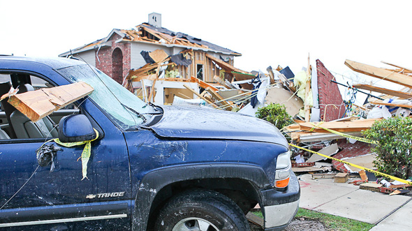
Note the 2×4 in the windshield of the truck, and the house to the right is gone! For an overhead look, downloading the original aerial shot (from our news story) of Arlington, Texas from the NWS-Fort Worth office, and pasting a Google shot into Photoshop, I came up with this (hover over the image for the “before”):
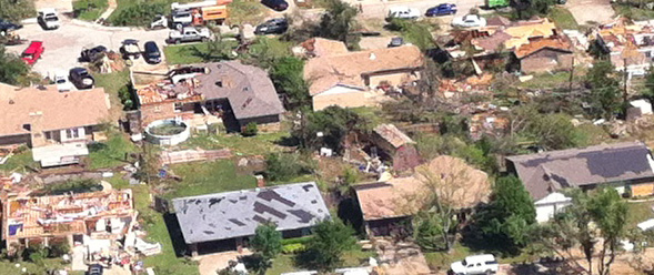
Note that the houses which didn’t have their roofs ripped off lost shingles in certain patterns. Given all this destruction it’s a miracle that no one was seriously injured by these storms. As Paul Douglas and Tim Marshall have discussed, hopefully we can learn some lessons about home construction this time around.
You Might Also Like Our Friends' Posts
Comments are closed for this story.


 Choosing from the best US Canadian and international sources, we gather and select weather stories from around the world. World Weather Post not only brings you breaking news about people affected by weather, but also provides insight on how weather is affected by people. You will also find a sense of humour and a curiosity for understanding the weather, climate change and the environment. World Weather Post, where everybody talks about the weather.