
Tropical Low 17U by Northern Territory and Western Australia


Tropical Low 17U – March 14th, 2012

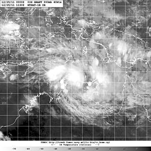
Enhanced image

Track of Tropical Low 17U
On March 9, an area of low pressure developed to the north of Kimberley. Over the next 3 days, the low moved into the Timor Sea, as the storm slowly intensified.
On March 12, TCWC Darwin reported that the storm had intensified into a tropical low, and gave it the identification 17U. As the storm approached the northern coast of Western Australia, it continued to intensify slowly. On March 14, Tropical Low 17U slowly began to weaken, as the storm made landfall on the northeastern border of Western Australia. Several hours later, 17U made a second landfall over the northwestern border of the Northern Territory. Afterwards, TCWC Darwin issued their last bulletin on the storm, as it degenerated into a weak low.
You Might Also Like Our Friends' Posts
Comments are closed for this story.



 Choosing from the best US Canadian and international sources, we gather and select weather stories from around the world. World Weather Post not only brings you breaking news about people affected by weather, but also provides insight on how weather is affected by people. You will also find a sense of humour and a curiosity for understanding the weather, climate change and the environment. World Weather Post, where everybody talks about the weather.