
Giovanna hits Madagascar; major damage likely

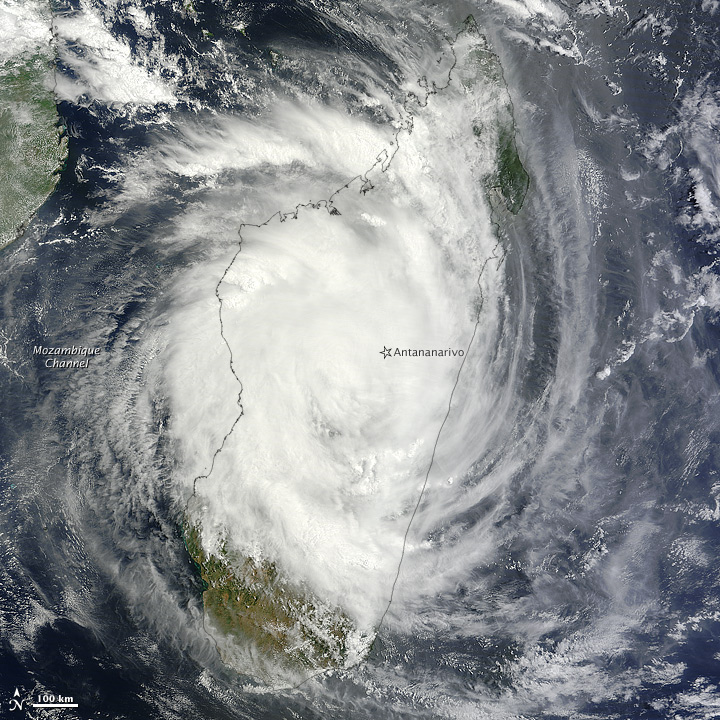
Figure 1. Visible image from NASA’s Terra satellite of Tropical Cyclone Giovanna over Madagascar, taken at 7:15 UTC Tuesday February 14, 2012. Seven hours previous to this time, Giovanna was a Category 2 storm with 110 mph winds, but had probably weakened to a Category 1 storm by the time this picture was taken. Image credit: NASA.
The forecast
Passage over the rugged terrain of Madagascar has significantly weaken Giovanna, and the cyclone will move into the Mozambique Channel between Madagascar and Mozambique as a tropical storm later today. Latest computer model forecasts from the GFS and ECMWF models suggest Giovanna may reintensify over water, and swing around and pass very close to the south tip of Madagascar early next week. Meanwhile, Madagascar must also keep an eye on Tropical Cyclone Thirteen, which is gathering strength over the waters to the east of the island, and is on a course that will bring it close to Madagascar this weekend.

Figure 2. Microwave satellite image of Tropical Cyclone Giovanna taken at 02:44 UTC Tuesday, February 14, 2012. The cyclone was still a well-organized Category 2 storm at this time, five hours after landfall. Image credit: Navy Research Lab, Monterrey.
Jeff Masters
You Might Also Like Our Friends' Posts
Comments are closed for this story.


 Choosing from the best US Canadian and international sources, we gather and select weather stories from around the world. World Weather Post not only brings you breaking news about people affected by weather, but also provides insight on how weather is affected by people. You will also find a sense of humour and a curiosity for understanding the weather, climate change and the environment. World Weather Post, where everybody talks about the weather.