
Tropical Cyclone Funso Still a Danger to Mozambique

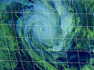
Tropical Cyclone Funso, located over the Mozambique Channel off mid Mozambique, on Monday, Jan. 23, 2012. (Joint Typhoon Warning Center)

By Jim Andrews, Senior Meteorologist
Jan 23, 2012; 10:00 AM ET
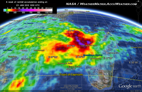
Powerful, dangerous Tropical Cyclone Funso has continued to lash central Mozambique with flooding rain and damaging winds, even as it drifts away from the immediate coast.
At least 10 people in Mozambique have been killed, and thousands of people have been driven from their homes, owing to a series of storms that began early last week, the AP said on Monday.
In an incident related to the early stages of Funso’s development, there were apparently no survivors from ferry carrying 54 people that sunk on Jan. 18 off the Comoros Islands, the French language linfo.re said. At least 15 bodies were recovered.
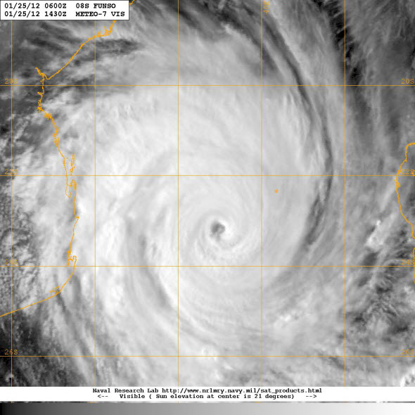
The Category 2 to Category 3 storm hovered nearly stationary within 50 to 100 miles the coast between the towns of Angoche and Quelimane between Friday and Sunday, when its center began to pull slowly away to the southeast.
Highest sustained winds since Friday have ranged mostly from 105 to 115 mph, according to the Joint Typhoon Warning Center (JTWC).
Owing to the long duration of high winds and torrential rain, reaches of the coast near the storm’s offshore center may have suffered severe damage. High waves and storm tides undoubtedly battered the coast.
Monday morning, top winds were reckoned by the JTWC to be about 115 mph, or those of a Category 3 hurricane. Drifting southeastward at less than 5 mph, the storm’s eye had slipped to more than 100 miles off the mid coast of Mozambique.
Official forecasts, such as that of the JTWC, have Funso remaining a powerful, dangerous cyclone over water for much of the week. Intensity is expected to reach Category 4 status. Movement is forecast to be mostly towards the east between Mozambique and Madagascar.
Forecast tools seen by AccuWeather.com tend to support the intensity and path favored by official meteorologists.
The most likely path would steer the worst of the storm’s potentially catastrophic winds away from land. Even so there is at least a small chance for a turn towards land.
You Might Also Like Our Friends' Posts
Comments are closed for this story.



 Choosing from the best US Canadian and international sources, we gather and select weather stories from around the world. World Weather Post not only brings you breaking news about people affected by weather, but also provides insight on how weather is affected by people. You will also find a sense of humour and a curiosity for understanding the weather, climate change and the environment. World Weather Post, where everybody talks about the weather.