
Denver’s Disruptive Snow Reaches Texas
Denver’s Disruptive Snow Reaches Texas
Oct 27, 2011; 6:52 AM ET
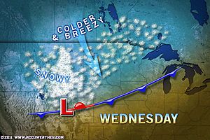
Residents of the Texas Panhandle and neighboring New Mexico are waking up this morning to the same travel-disrupting snow Denver experienced on Wednesday.
Snow has been falling from the Interstate 40 corridor from the Texas Panhandle to eastern New Mexico since Wednesday night and it will continue to do so through midday today.
Snow totals within this zone, which includes Amarillo, Texas, and Tucumcari, N.M., will amount to 1 to 3 inches.
Similar to what occurred in Denver, most of the snow will be confined to grassy and elevated surfaces. Motorists, however, should still use caution.
Parts of Interstate 40 and other roads, especially bridges and overpasses, will remain slick with temperatures hovering near freezing.
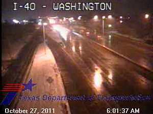
This web camera from the Texas Department of Transportation shows snow along Interstate 40, just west of the interstate’s intersection with I-27.
Conditions will improve this afternoon as the snow ends and even some sunshine returns.
As skies continue to clear overnight, a widespread freeze will grip the entire Texas Panhandle, northeastern New Mexico and the rest of the High Plains to the north.
The winter wonderland will not make any more progress across the southern Plains today. Instead, the region will welcome rain.
The rain will continue to push from western Texas and Oklahoma into the Arklatex through tonight, passing over Oklahoma City and Dallas in the process.
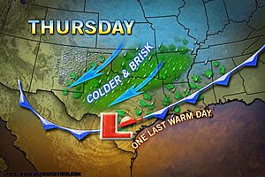
Rain totals across this zone will generally remain under an inch, but most places will pick up at least a quarter of an inch.
While that amount will definitely not bring an end to the region’s prolonged drought, any measurable rain is a welcome sight.
Central and South Texas will not benefit as much as places to the north. Only spottier showers and thunderstorms will dot the region.
The one thing all of the southern Plains will experience over the next 24 hours is a dramatic drop in temperatures.
By Kristina Pydynowski, Senior Meteorologist
You Might Also Like Our Friends' Posts
Comments are closed for this story.


 Choosing from the best US Canadian and international sources, we gather and select weather stories from around the world. World Weather Post not only brings you breaking news about people affected by weather, but also provides insight on how weather is affected by people. You will also find a sense of humour and a curiosity for understanding the weather, climate change and the environment. World Weather Post, where everybody talks about the weather.