
Heat-Busting Strong Storms Target Plains

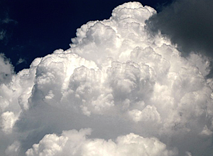
AccuWeather.com Facebook fan Sarah S. took this photo of a thunderstorm at the Isle of Palms, S.C., last week.

Thunderstorms rolling across parts of the central and northern Plains later today through tonight could be severe, but will also signal the arrival of cooler air.
A cold front emerging from the northern Rockies will trigger the storms this afternoon, first targeting the western High Plains from northeastern Colorado around Denver to the western Dakotas.
Driven by fast winds high in the atmosphere, strong thunderstorms will survive well after sunset and through the overnight hours as they advance east across the Dakotas and into northwestern Minnesota by the early morning hours of Friday.
Cities threatened by storms include: Cheyenne, Wyo.; Scottsbluff, Neb.; Pierre and Rapid City, S.D.; Bismarck and Fargo, N.D.; and International Falls, Minn. Communities across southern Manitoba and far southwestern Ontario in Canada will also be at risk for strong storms.
The parent low pressure system driving today’s storms produced damage across northern Montana late Wednesday. Three people sustained minor injuries when wind gusts clocked at 80 mph knocked down trees and power lines while blowing out large windows at Jackson Lake Lodge near Moose, Wyo.
Another storm briefly spawned a tornado west of Glasgow, while others dropped hail larger than baseball size.
While a tornado or two is possible today as well, the primary threat will continue to be brief, but powerful wind gusts and damaging hail.

Winds from a few thunderstorms will be strong enough to topple trees and power lines. A greater proportion of storms will be able to bring down smaller tree limbs, which poses a threat to motorists in addition to homeowners.
The cold front pushing through with the storms will usher in cooler air for the end of the week. Many locations will reach into the 90s a few hours prior to the arrival of thunderstorms.
Unfortunately, those locations at the core of the heat wave over the central and southern Plains will avoid cooling rain today and tonight and challenge record highs above the century mark.
By Bill Deger, Meteorologist
Jun 30, 2011; 9:25 AM ET
You Might Also Like Our Friends' Posts
Comments are closed for this story.


 Choosing from the best US Canadian and international sources, we gather and select weather stories from around the world. World Weather Post not only brings you breaking news about people affected by weather, but also provides insight on how weather is affected by people. You will also find a sense of humour and a curiosity for understanding the weather, climate change and the environment. World Weather Post, where everybody talks about the weather.