
Florida Coastal Storm Originated As Missouri MCS
Florida Coastal Storm Originated As Missouri MCS
Jun 1, 2011; 8:45 AM ET
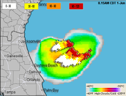
The storm system moving into eastern Florida from the northeast today (quite unusual) is the remnants of a Mesoscale Convective System (MCS: a large cluster of organized thunderstorms) that originated in Missouri on the morning of May 29th. Three days later, this is what it looks like approaching the state, when you overlay lightning strikes on top of the Enhanced Infrared Satellite via MapSpace:
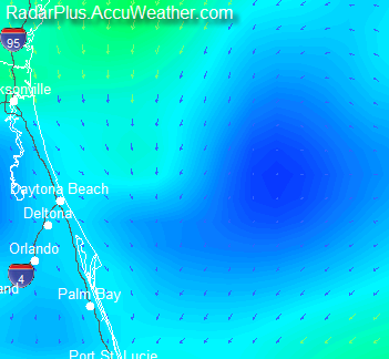
Our news article on the system says “The system… may behave a bit like a tropical storm with a brief period of gusty winds and localized flooding downpours.” Most of those winds are going to come from the thunderstorms themselves, as the surface (model) analysis from RadarPlus this morning shows a weak counterclockwise rotation but almost no large-scale winds:
The image below shows a closeup Visible Satellite with wind direction and (positive-only) lightning strikes overlaid.

Here’s a satellite loop showing the origin of the storm, and an Enhanced Satellite Loop showing the storm last night.
You Might Also Like Our Friends' Posts
Leave a Reply


 Choosing from the best US Canadian and international sources, we gather and select weather stories from around the world. World Weather Post not only brings you breaking news about people affected by weather, but also provides insight on how weather is affected by people. You will also find a sense of humour and a curiosity for understanding the weather, climate change and the environment. We encourage you to use our blog to express your opinion and share your stories and knowledge. World Weather Post, where everybody talks about the weather.